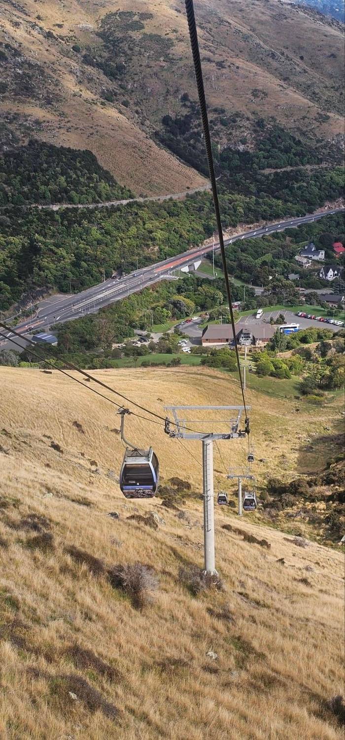
No walking
Level 4 deck
Straight off the cabin
- WhereLevel 427
- FacesCity and harbor
- Next toCafé and shop
Locate your stop
Short answer
The view from the Christchurch Gondola takes in Lyttelton Harbour, its port and islands on one side, and the city, the Canterbury Plains and the Southern Alps on the other, with Pegasus Bay and the Pacific beyond.
Look for
Browse 23 stops
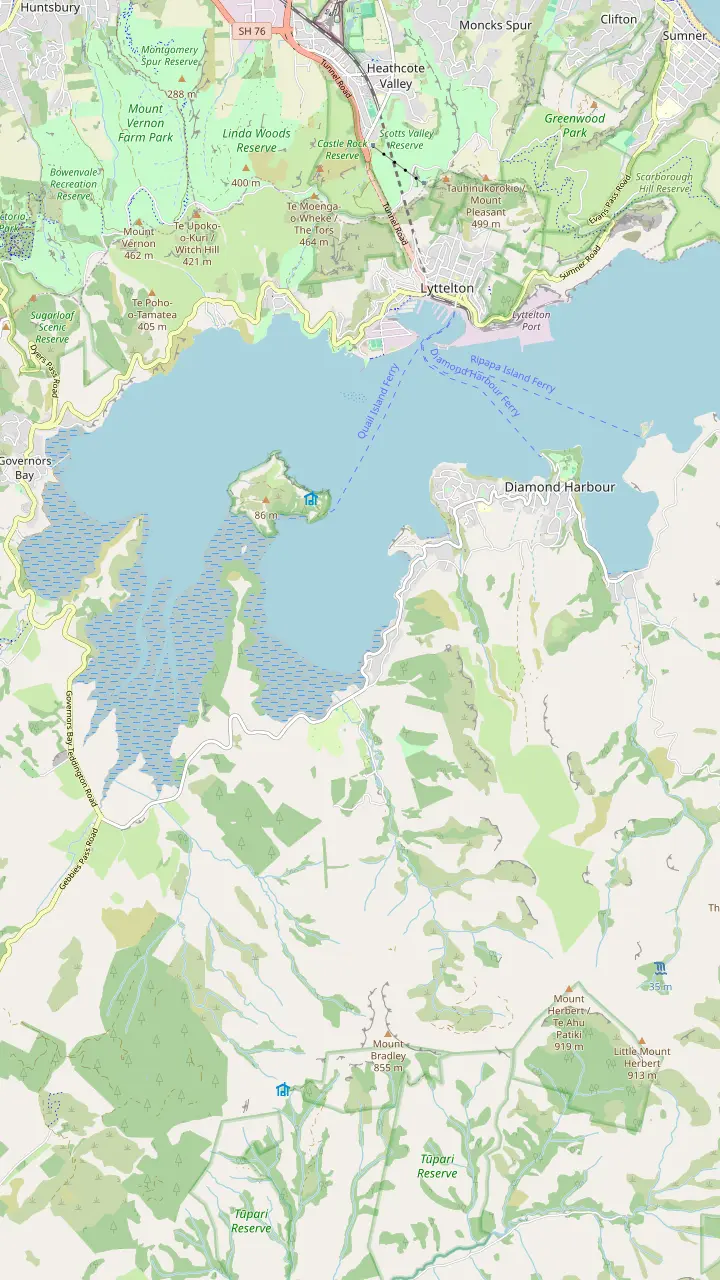
Tap a route first, then a pin or stop, for its note and Google Maps.
The harbour's old time signal: be there at 1pm to watch the ball drop.
Google MapsA ferry crosses from Lyttelton; settlers named the bay for the sun sparkling on the water.
Google MapsTe Ahu Pātiki, 919 metres, the highest peak on Banks Peninsula.
Google MapsHome of Te Hapū o Ngāti Wheke, one of the papatipu rūnanga of Ngāi Tahu.
Google MapsThe cone-shaped hill rising over Rāpaki, the mauka named in the Ngāti Wheke pepeha.
Google Maps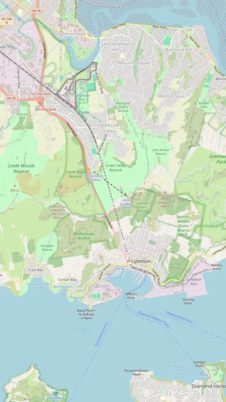
Café, Discovery Ride and shop on top of Mount Cavendish; all three shut 30 minutes before the last ride down.
Google MapsA stone shelter from 1940 honouring Canterbury's pioneer women, 1 hour return on foot from the summit station.
Google MapsWartime gun emplacement remains at the end of a 5.2km return walk from the summit, with little shade on the way.
Google MapsTe Tihi o Kahukura, the rock outcrop on a tight bend of the Summit Road above Ferrymead.
Google Maps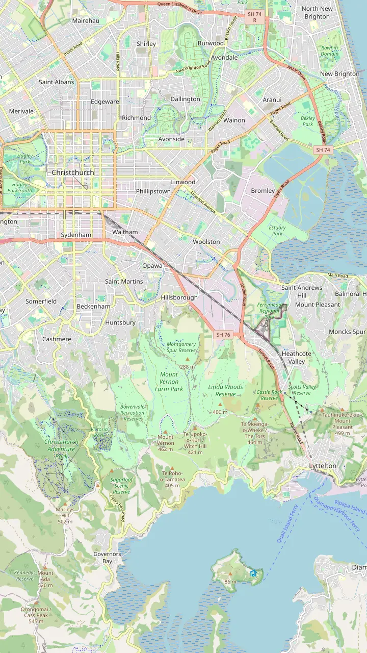
The Gondola Shuttle starts from Tram Stop 2 in the square.
Google MapsCatch bus 8 towards Lyttelton here, on the corner of Colombo and Lichfield Streets.
Google Maps10 Bridle Path Road, with plenty of parking for cars and coaches.
Google MapsBus 8 from Lyttelton drops you at the gondola's door; the operator allows 5 minutes by taxi or bus.
Google MapsThe valley the base station sits in; the city end of the Bridle Path starts just below the gondola.
Google Maps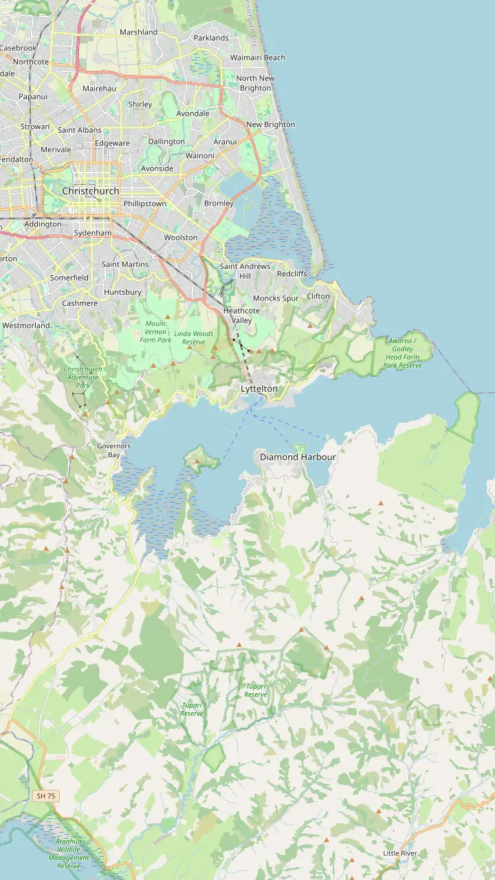
The transmission tower on its top stands at an elevation of 493.78 m, near Dyers Pass.
Google MapsThe Sign of the Kiwi, a rest house from Harry Ell's Summit Road plan; the Crater Rim walk to the Sign of the Bellbird starts here, 4km.
Google MapsThe Sign of the Takahe, a stone building Harry Ell planned in 1918.
Google MapsŌmāwete, the highest point of the Port Hills, 20 minutes one way from the Summit Road.
Google MapsŌrongomai, where Ngāti Wheke tradition says Ngāi Tahu heard Ngāti Mamoe.
Google MapsChristchurch's original downhill riding area with 71 trails, plus the Harry Ell Walkway, 4km.
Google MapsA 1.8 kilometre chairlift built to carry riders and bikes; entry to the park is free.
Google MapsThe coastal end of the hills, with 120-metre cliffs and wartime gun emplacements.
Google MapsThe Summit Road over Evans Pass, finished in 1857, ended the Bridle Path's days as the only way over.
Google Maps© OpenStreetMap contributors · map data
The view from the Christchurch Gondola takes in a flooded volcanic harbor on one side and a city, a plain and a mountain range on the other. This is how to read it, peak by peak and bay by bay.
Editorial team, christchurchgondola.top · Updated November 8, 2026 · 6 mins to read
Main facts
The view from the Christchurch Gondola is really two views, split by the ridge you are standing on. The operator describes panoramic views of the city, Lyttelton Harbour, the Pacific Ocean and beyond.1 ChristchurchNZ adds the Southern Alps and the Canterbury Plains to the list.2 Walk from one side of the deck to the other and the scene changes completely, from sea and hills to a flat city and distant snow.
That contrast is the whole point of the ride. On the harbor side you look down into a deep, sheltered inlet ringed by steep green slopes. On the city side the land drops away to a grid of streets that runs out to the coast and the plains. A harbor, a city and a mountain chain from the same hilltop, and a cabin ride of around 10 minutes to reach it.6
To put names to what you are looking at, use the operator's own guide. QR codes placed around the summit station open a Scan & Learn site that explains the sights in view.5 Its pages cover the harbor settlements, the islands, the peaks and even the airport, and they make a useful companion while you stand at the rail picking out landmarks.
Landmarks
| Landmark | Side of the ridge | Worth knowing |
|---|---|---|
| Lyttelton | Harbor | A port since 1849 |
| Quail Island | Harbor | 81 hectares, 3 km from the port |
| Mount Herbert | Harbor | 919 metres |
| New Brighton | City | 8 kilometres east of the center |
| Waimakariri River | City | 151 kilometres to the sea |
| Southern Alps | City | About 500km long |
From the operator's Scan & Learn guide to the sights seen from the summit.8,24,20,25,26,4
The view of Lyttelton Harbour from the Christchurch Gondola is the place to begin. The harbor is Whakaraupō, a name Ngāti Wheke tradition says Tamatea gave after the raupō growing at its head.12 The Bridle Path, which crosses the ridge near the summit, is described by the operator's guide as following the northern rim of the Lyttelton volcano.13
Directly below sits Lyttelton itself. It was proclaimed a port in August 1849.8 Antarctic expeditions later sailed from it, Scott's Discovery in 1901 and Terra Nova in 1910, and Shackleton's Nimrod in 1908.11 Watch for ships working the wharves below; from this height they look like toys. A rail tunnel through the hills opened in 1867 and a road tunnel in 1964, and traffic now reaches the port through them instead of over the ridge.10
Across the water lies Diamond Harbour, linked to Lyttelton by ferry and named by settlers for the way sunlight glittered on the bay.14,15 Rāpaki, on the near shore, is home to Te Hapū o Ngāti Wheke, one of the papatipu rūnanga of Ngāi Tahu.16 Pick it out by the cone-shaped hill above it, Te Poho o Tamatea.17
On the skyline
The island in the upper harbor is Quail Island, about 81 hectares in size and roughly 3 km from the port.24 Ngāi Tahu knew it as Ōtamahua, the place where children gathered the eggs of seabirds.34 From the summit it looks close enough to swim to, which gives a sense of how sheltered and compact this harbor is.
Its later history is less gentle. Between 1901 and 1929 it served as an animal quarantine station for several Antarctic expeditions, the same expeditions that left from the port below you.35 Seen from above, the island ties together the two stories the harbor tells, the older Māori names and food-gathering places and the later age of ships, quarantine and polar exploration.
Behind the island the land climbs again to Mount Herbert, Te Ahu Pātiki. At 919 metres it is the highest peak on Banks Peninsula.20 On a still morning its long, flat-topped ridge is often the clearest line on the far side of the water.
Pick your view
Choose what you came for and head to the spot that frames it best.
If I want the harbor and the port
Cavendish Bluffs track
A short return walk to a bluff above the harbor.28
If I want mountains
The city side, on a clear day
The Alps and the plains lie that way.2
If I want the ocean
The coast beyond the city
Pegasus Bay and the Pacific are visible from the ride.3
If I want the widest panorama
The Pioneer Women's Memorial
Views of the harbor, the city and across the plains.32
If I want to name every peak
Scan the QR codes
They open the operator's guide to the sights.5
If I cannot walk far
The café level, by lift
A lift serves the café and observatory level.33
Viewpoints
No walking
Straight off the cabin
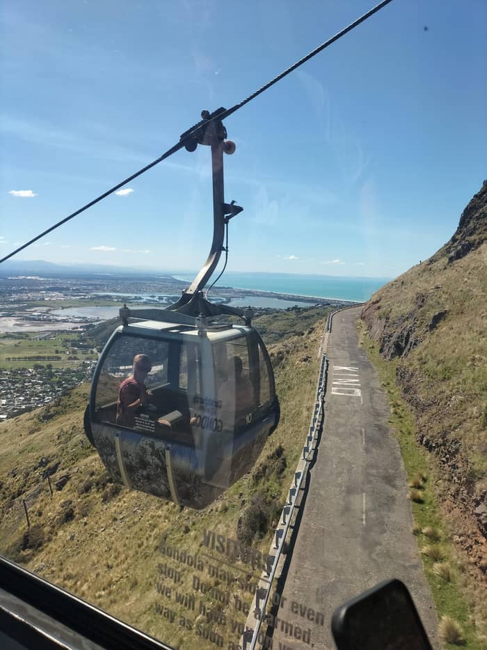
Easy walk
Short harbor lookout
Ride up for the view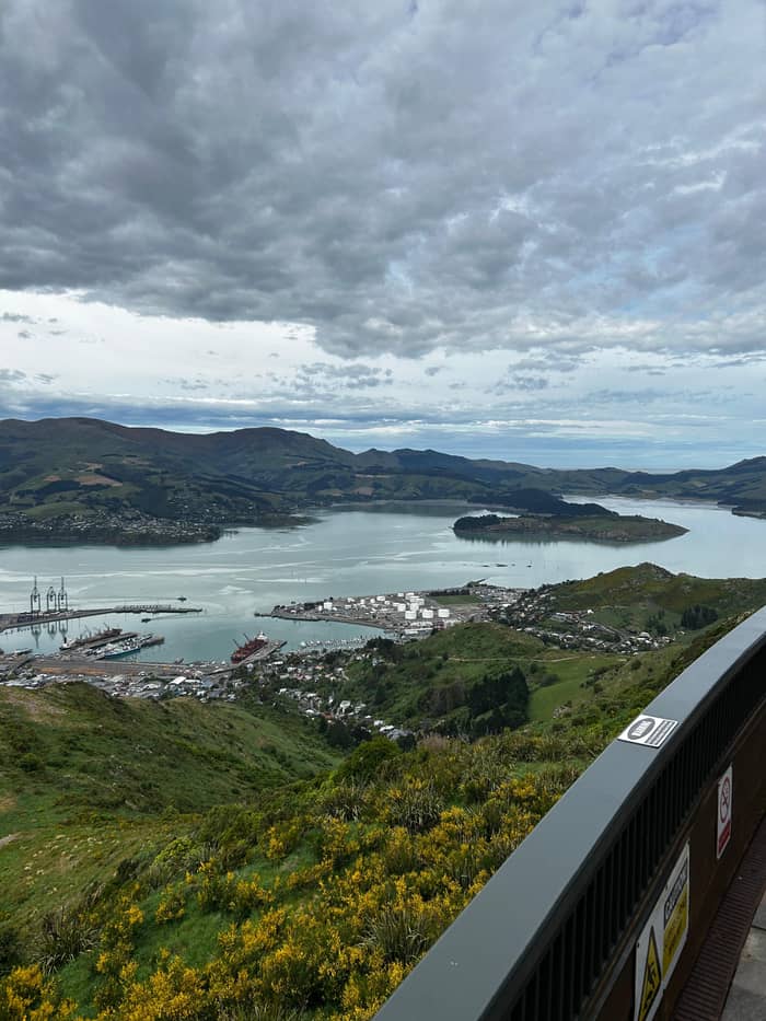
Moderate walk
Stone shelter on the crest
Ride up for the viewTurn around and the Christchurch skyline from the gondola spreads out below, low and wide rather than tall. The city sits on flat land between the hills and the sea, and the operator's guide reminds you that the 22 February 2011 earthquake was centred close to Lyttelton, only 5 km below the surface.69 The low skyline you see today is the city that has grown back since.
Follow the coast north and the long beach at New Brighton, about 8 kilometres east of the city center, runs off into the distance.25 Beyond it the sweep of Pegasus Bay meets the Pacific Ocean.3 The operator's guide even gives a page to Kaikōura, up the coast, where the Seaward Kaikōura mountains come almost down to the sea.70
Inland, look for the runways of Christchurch Airport, which became the first international airport operating in New Zealand in 1950.71 The Waimakariri River crosses the plain from the Alps to the ocean over 151 kilometres, a pale braid of shingle north of the city.26 Its name joins wai, water, and makariri, cold.72 Trace the river back toward the mountains and you are following the route the snowmelt takes from the range you can see to the ocean behind you.
The harbor below
1770
Cook sighted the peninsula on 16 February 1770.7
1849
Lyttelton became an official port in August 1849.8
1850
Built for leading horses over the hills.9
1867
The rail tunnel to Lyttelton opened.10
1901
Scott's Discovery sailed from the harbor.11
1964
Vehicles no longer had to cross the ridge.10
West of the city the Canterbury Plains run flat to the foot of the mountains, and on a clear day the Southern Alps stand along the horizon. The range runs approximately 500km from northeast to southwest.4 Its tallest peak, Aoraki / Mount Cook, rises to 3,724 metres, far down the range.23
Two nearer mountains are easier to spot. Mt Hutt, Huirapa/Ōpuke, at 2159m, is home to a commercial ski area.22 To the north, Mt Grey / Maukatere is a 934 metre mountain west of Amberley, and its Māori name is given as floating mountain.21,73
South of the hills, Lake Ellesmere / Te Waihora spreads across 198 square kilometres west of Banks Peninsula.74 Te Waihora means spreading waters.75 Its outline is easier to understand on a map than from the ridge, so look it up before you go and then try to match the shapes on the horizon. It is one of the sights the operator's guide describes, and a reminder of how much water surrounds this peninsula.
Video
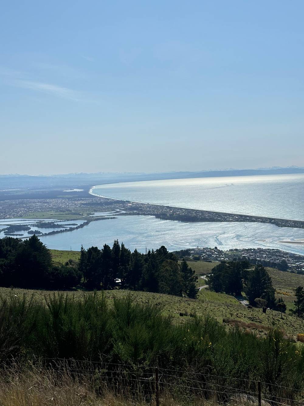
AusFlyer on YouTube · The clip loads only after you tap play.
Ngāi Tahu knew Quail Island as Ōtamahua, which means the place where children collected sea birds’ eggs
View checklist
The Level 4 viewing deck is the obvious place to start, and stairs from it lead down to the grass and the walking tracks.27 The function rooms upstairs are promoted for their views across Christchurch to the Southern Alps.76
For the harbor, a short walk does better than the deck. The Cavendish Bluffs Lookout Track is a 30 minute return walk to a bluff above Lyttelton Harbour/Whakaraupō, with a bench along the way and a view back to the station.28,77 It is easy, though it has steps and some steep sections.29
For the widest panorama, the Pioneer Women's Memorial track is a 2km walk of about 1 hour return31 and opens views over the harbor, the city and across the Canterbury Plains.30,32 The longer track to the gun emplacements near Mount Pleasant brings the Pacific Ocean into the frame as well.78 Expect a moderate walk of 5.2km there and back, with some steep sections and uneven terrain.38
Visibility decides how much of this you will see. The plains and the Alps are distant and need clean air, while the harbor sits right below you. ChristchurchNZ describes an easy 180 degree city vista from the Port Hills.63 If the mountains are hidden, the harbor directly below still rewards the trip.
Winter has its own appeal. ChristchurchNZ's family itinerary pictures the gondola ride with snow on the Southern Alps, the plains spread out and Pegasus Bay sparkling.3 Bring a warm layer: the operator's advice for the summit tracks includes warm layers, sturdy shoes and a sun hat.66
Give yourself time. The operator suggests 1 to 2 hours for a visit, which leaves room to wait out a passing cloud.64 Check the forecast on the morning you go, look at the hills from the city before you set off, and if the summit is wrapped in cloud, use the time for the history ride and the café and go back out once it lifts.
FAQ
It is an 81-hectare island about 3 km from the port of Lyttelton.24
Te Ahu Pātiki is the highest peak on Banks Peninsula.20
QR codes around the summit station open the operator's Scan & Learn guide to the sights.5
It is a 30 minute return walk to a bluff overlooking Lyttelton Harbour/Whakaraupō.28
Sources
Planning a ride up the Port Hills? A real person answers here.