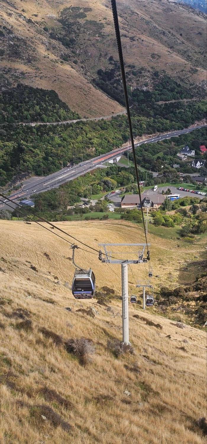
No climbing
Gondola
From Heathcote Valley
See this way upLocate your stop
Short answer
The Port Hills in Christchurch are the worn rim of the old Lyttelton volcano between the city and its port, topped by Coopers Knob and crossed by Harry Ell's Summit Road with its lookouts and rest houses.
Good to know
Browse 23 stops
Tap a route first, then a pin or stop, for its note and Google Maps.
The transmission tower on its top stands at an elevation of 493.78 m, near Dyers Pass.
Google MapsThe Sign of the Kiwi, a rest house from Harry Ell's Summit Road plan; the Crater Rim walk to the Sign of the Bellbird starts here, 4km.
Google MapsThe Sign of the Takahe, a stone building Harry Ell planned in 1918.
Google MapsŌmāwete, the highest point of the Port Hills, 20 minutes one way from the Summit Road.
Google MapsŌrongomai, where Ngāti Wheke tradition says Ngāi Tahu heard Ngāti Mamoe.
Google MapsChristchurch's original downhill riding area with 71 trails, plus the Harry Ell Walkway, 4km.
Google MapsA 1.8 kilometre chairlift built to carry riders and bikes; entry to the park is free.
Google MapsThe coastal end of the hills, with 120-metre cliffs and wartime gun emplacements.
Google MapsThe Summit Road over Evans Pass, finished in 1857, ended the Bridle Path's days as the only way over.
Google Maps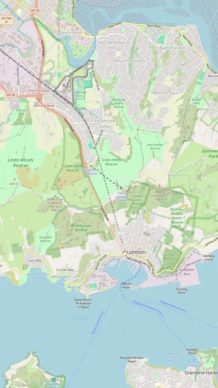
Café, Discovery Ride and shop on top of Mount Cavendish; all three shut 30 minutes before the last ride down.
Google MapsA stone shelter from 1940 honouring Canterbury's pioneer women, 1 hour return on foot from the summit station.
Google MapsWartime gun emplacement remains at the end of a 5.2km return walk from the summit, with little shade on the way.
Google MapsTe Tihi o Kahukura, the rock outcrop on a tight bend of the Summit Road above Ferrymead.
Google Maps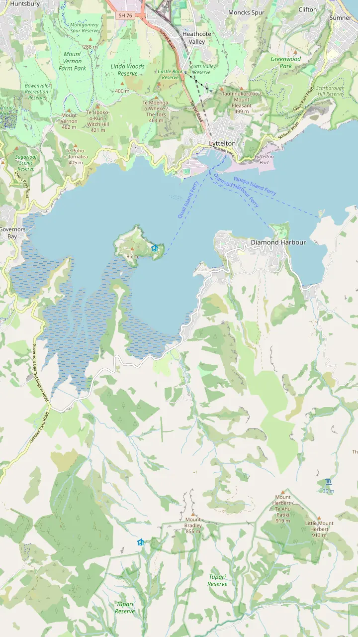
The harbour's old time signal: be there at 1pm to watch the ball drop.
Google MapsA ferry crosses from Lyttelton; settlers named the bay for the sun sparkling on the water.
Google MapsTe Ahu Pātiki, 919 metres, the highest peak on Banks Peninsula.
Google MapsHome of Te Hapū o Ngāti Wheke, one of the papatipu rūnanga of Ngāi Tahu.
Google MapsThe cone-shaped hill rising over Rāpaki, the mauka named in the Ngāti Wheke pepeha.
Google Maps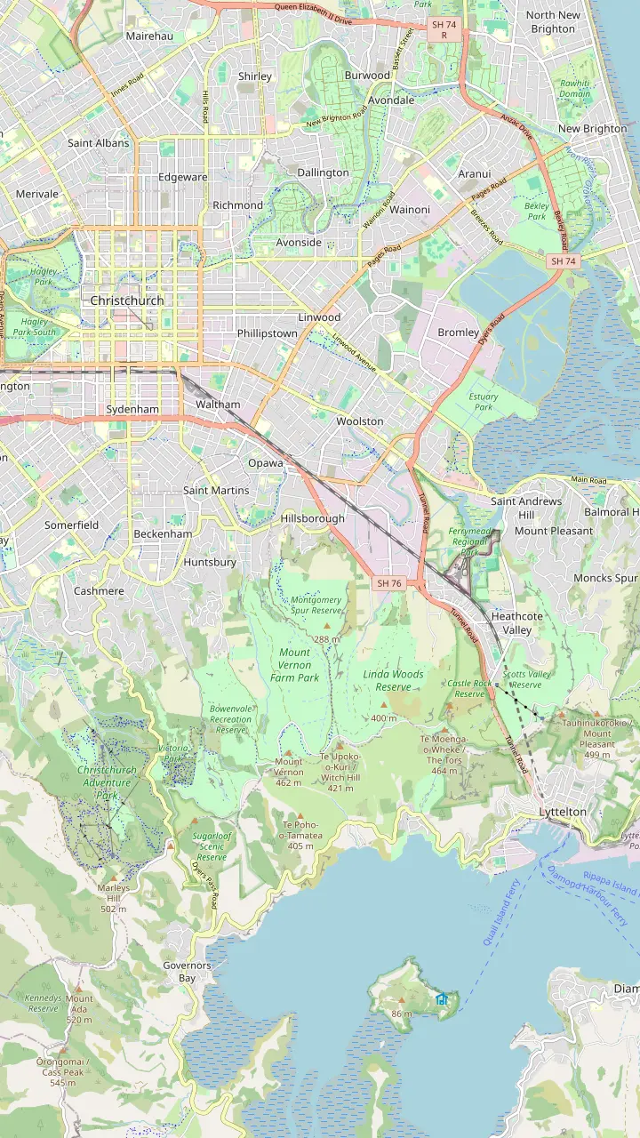
The Gondola Shuttle starts from Tram Stop 2 in the square.
Google MapsCatch bus 8 towards Lyttelton here, on the corner of Colombo and Lichfield Streets.
Google Maps10 Bridle Path Road, with plenty of parking for cars and coaches.
Google MapsBus 8 from Lyttelton drops you at the gondola's door; the operator allows 5 minutes by taxi or bus.
Google MapsThe valley the base station sits in; the city end of the Bridle Path starts just below the gondola.
Google Maps© OpenStreetMap contributors · map data
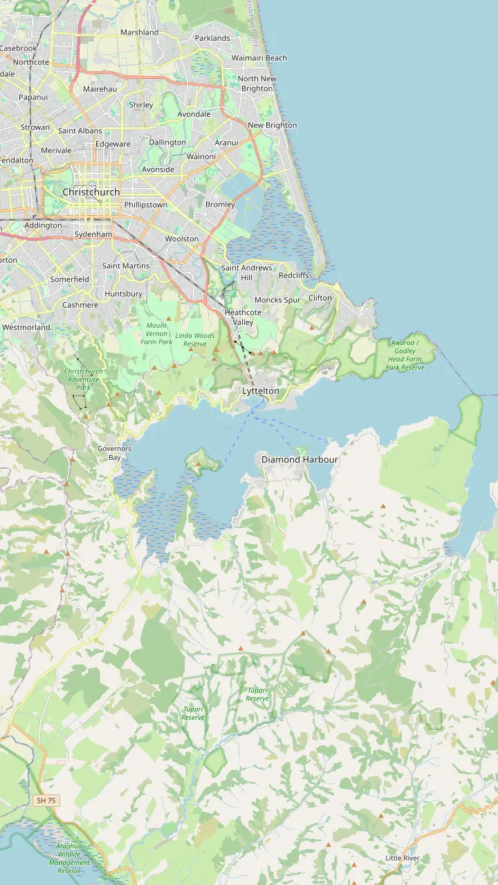
The Port Hills in Christchurch are the green wall between the city and its port, the worn rim of an ancient volcano. Here are their names, their high points, the road along the top and the lookouts worth stopping at.
Editorial team, christchurchgondola.top · Updated November 8, 2026 · 7 mins to read
Main facts
So where are the Port Hills in Christchurch? They are the ridge that rises straight out of the city's southern suburbs and drops on its far side into Lyttelton Harbour, with the port tucked against the water. The gondola climbs their northern face, and the Bridle Path crosses them on what the operator's guide calls the northern rim of the Lyttelton volcano.1
That word, rim, is the key to the landscape. ChristchurchNZ describes scrambling on Coopers Knob as climbing on top of what was once a large volcano.7 The harbor below sits inside that old rim, and the hills you walk on are what remains of its wall, worn down into crags, tors and grassy saddles.
The volcano gives the hills their shape, steep on the harbor side and long and ridged on the city side, with spurs and gullies running down into suburbs such as Heathcote, Cashmere and Sumner. From the city you see them as a single wall; on top you find a maze of peaks, saddles and reserves, threaded together by tracks and a road along the crest.
Lookouts compared
| Lookout | How you get there | Known for |
|---|---|---|
| Summit Road carpark | Drive | Lyttelton Harbour view |
| Coopers Knob | 20 minutes on foot | Highest point |
| Castle Rock | Summit Road bend | Rock outcrop |
| Sign of the Kiwi | Summit Road | Sunset stop |
| Godley Head | 7km walk | 120-metre cliffs |
| Gondola summit | Gondola | Harbor and city |
From ChristchurchNZ and the operator's guide; Coopers Knob is 20 minutes one way, the Godley Head walk 7km.24,25,2,18,5,26,20,27
Long before the English names, these hills carried names from Māori tradition, and the hapū of Rāpaki, Ngāti Wheke, publish their own account of them. In it the cone-shaped hill that dominates Rāpaki is Te Poho o Tamatea, and their pepeha names it as the mauka, with Whakaraupō as the moana.13,14
The account tells of the explorer Tamatea stopping in the hills above Rāpaki when a southerly storm struck, and calling on his atua for fire; Pākeha later named that same hill Rāpaki Rock.15,16 Peaks at the head of the harbor recall contests between Ngāi Tahu and Ngāti Mamoe. Ōrongomai, Cass Peak, marks where Ngāi Tahu heard their rivals, and Ōmāwete, Coopers Knob, is described as a rare recognition of the defeated side.17,3
Other names on the ridge come from the same world. Te Tihi o Kahukura, Castle Rock, is the outcrop on a tight bend of the Summit Road above Ferrymead; tihi means summit, and Kahukura is an atua whose stories include taking the form of a rainbow.18,19 Use these names on the hill and you will find them on signs and maps alongside the English ones.
Height
How high are the Port Hills in Christchurch? Higher than they look from the plains. ChristchurchNZ names Coopers Knob as the highest point of the range.2 The Sugarloaf transmission tower stands at an elevation of 493.78 m, near Dyers Pass, on a peak that ChristchurchNZ describes as nearly 500 metres high.23,34
Lower crossings give a sense of the climb from sea level. The Bridle Path rises from the port to a height of 333 m before dropping into Heathcote Valley.21 On the city side, the Rāpaki Track gains 333m over 3.6kms, a steady haul that cyclists share with walkers.22 The lattice tower on Sugarloaf is itself 121 m high, and it makes a handy marker when you are trying to place the ridge from below.35
Across the harbor the land climbs higher still. Mount Herbert, Te Ahu Pātiki, reaches 919 metres and is the highest peak on Banks Peninsula, though it belongs to the peninsula rather than to the Port Hills themselves.36 Standing on the crest you can compare the two skylines and see how the old volcanoes stack up behind each other.
Plan your visit
Pick the spot by what you hope to get from the hills on the day.
If I want the harbor view without a hike
Summit Road carpark
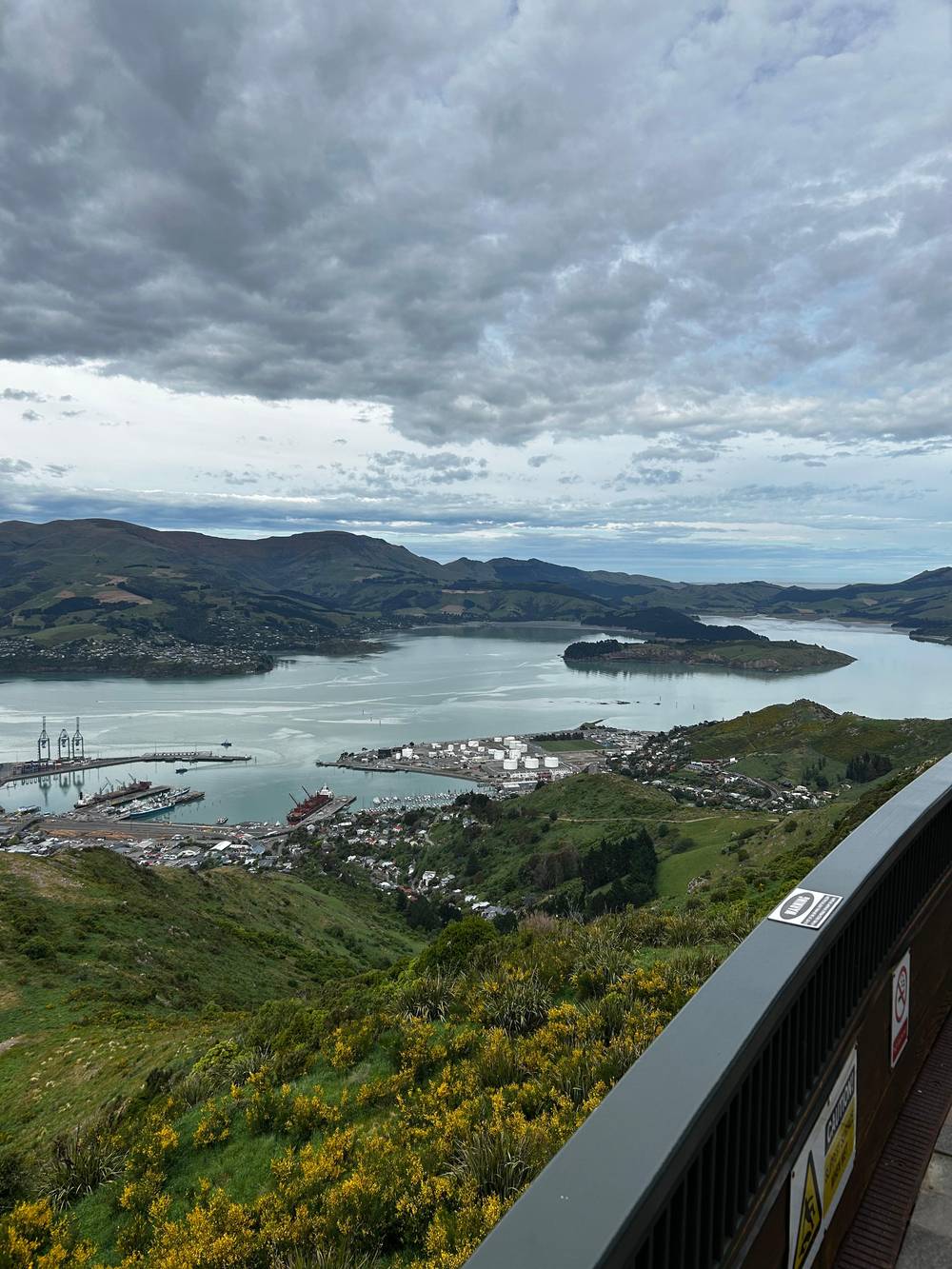
A contender for the best view of Lyttelton Harbour.24
If I want to stand on the top
Coopers Knob
If I want sea cliffs
Godley Head
Cliffs of 120 metres and wartime gun sites.20
If I want a sunset
Summit Road or Rāpaki
Both are suggested sunset stops.5
If I want history
The Summit Road rest houses
Harry Ell's buildings line the ridge.4
If I want an easy ride up
The gondola
Around 10 minutes in a cabin.28
Ways up
No climbing
From Heathcote Valley
See this way up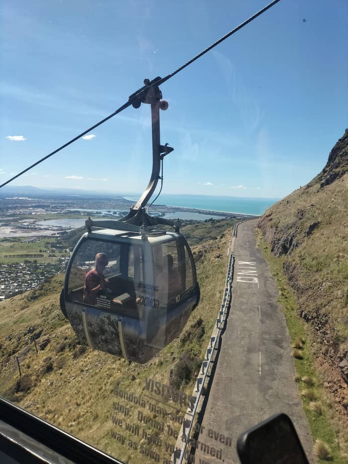
On foot
Walk up from Hillsborough
See this way upLift and trails
Chairlift in Cashmere
See this way upThe road along the top is the work of one persistent man. The operator's guide tells how Harry Ell imagined a highway with walking tracks and rest houses running along the summit of the Port Hills.64 Development ran through the depression years of the 1920s and 1930s, and by his death in 1934 he had laid the foundations of the Summit Road and its rest houses.65,4
The rest houses still stand along the ridge. ChristchurchNZ dates the stone Sign of the Takahe to 1918, a building Harry Ell planned.11 Further along, the Sign of the Kiwi marks the start of a 4km Crater Rim section that ends at the Sign of the Bellbird.46 Together they turn a drive along the Summit Road into a string of stops.
An older road crosses the eastern end, over Evans Pass; it was finished in 1857, and before it the steep Bridle Path was the settlers' sole route across.10 Today the ridge is reached by car, by the gondola from Heathcote Valley, by the chairlift at the Adventure Park or on foot from the city.66 On the western side, the Christchurch Adventure Park lets anyone in free of charge, its chairlift runs 1.8 kilometres up the slope, and a rider must be over 1m tall to use it.32,31,33
Through time
1770
Cook sighted Banks Peninsula on 16 February 1770.8
1850
A track for leading horses over the hills.9
1857
The Summit Road over Evans Pass was completed.10
1918
Harry Ell planned the stone rest house.11
2017
A wildfire began on Marleys Hill on 13 February 2017.12
2024
It covered 650 hectares.6
Every Port Hills lookout has its own angle. ChristchurchNZ suggests the Summit Road carpark as a contender for the best view of Lyttelton Harbour.24 For height, the Coopers Knob walk begins from Summit Road a little north of the Gibraltar Rock carpark, a climb of 20 minutes one way with some easy scrambling on top.25,7
At the coastal end, Godley Head has gun emplacements and ocean views from 120-metre-high cliffs.20 Its track looks out over Pegasus Bay and the Kaikōura Ranges.67 The walk from Taylors Mistake is 7km, a 3-hour round trip.26
Climbers see the hills differently. Cattlestop Crag, above Heathcote Valley, has more than 100 routes, and you reach it by parking on Summit Road near the gondola building.68,69 Gibraltar Rock has 14 routes overlooking the Canterbury Plains.70 Even if you never rope up, these crags are good places to watch the light change over the plains.
Video
Glen And Mado on YouTube · The clip loads only after you tap play.
Nearby, the distinctive cone-shaped hill which dominates Rāpaki is Te Poho o Tamatea
Hill checklist
For a Port Hills sunset, ChristchurchNZ points to stops along the Summit Road, the area near the top of Rāpaki and the viewpoint by the Sign of the Kiwi.5 Seeing the city lights come on below you is a fine end to a day, but plan the way down before dark: the tracks are unlit and steep in places.
The ridge is exposed. ChristchurchNZ warns that the top of the Rāpaki Track can be windy and suggests packing a warm layer or a windbreaker.56 It also warns that a winter's day here can run through every season, and recommends layers and sturdy, waterproof shoes.57 Treat a calm morning in the city as no guarantee of calm on the crest. For a family outing, ChristchurchNZ rates the Rāpaki Track, 7km and 2 hours return, as fine for off-road prams.29,30
The gondola feels the same weather. When conditions turn, Metro notes, it can stop early or stay shut for the day, and bus 8 then skips the stop at its base.58 On a doubtful day, check the operator's hours before you leave, and keep a plan for the city in reserve.
The hills have burned twice in recent years. A wildfire that began on 13 February 2017 on Marleys Hill reached the boundary of the Christchurch Adventure Park by the next evening.12 In 2024 the Valentine's Day fire covered 650 hectares with a perimeter of 24km.6 At its height more than 130 firefighters, 15 helicopters and two fixed-wing aircraft worked the blaze.71
Most of that land was private. Of the 650ha burned, 28ha was council reserve.72 The council says it applied lessons from the 2017 fire, including declaring a state of emergency promptly.62 Fire and Emergency staff say they are planting less flammable species across the Port Hills together with the council and local iwi.73
Replanting is a long project. The Te Tapuwae o Rakau Trust aims to replant over 10 million native trees on the Port Hills.74 At the gondola, the operator reports more than 100 native trees planted with the trust and the Duke of Edinburgh's Hillary Award.75 Native bush grows slowly, and the work being done now will shape how these hills look for decades.
FAQ
They form the ridge from the city's southern suburbs to Lyttelton Harbour; the Bridle Path follows the rim of the old Lyttelton volcano.1
The Bridle Path crosses the northern rim of the Lyttelton volcano.1
He laid the foundations for the road and its rest houses by his death in 1934.4
ChristchurchNZ points to pull-ins along the Summit Road, the upper end of the Rāpaki Track and the lookout beside the Sign of the Kiwi.5
ChristchurchNZ advises a warm layer or windbreaker for the top of the Rāpaki Track.56
Sources
Planning a ride up the Port Hills? A real person answers here.