Easy
Cavendish Bluffs
Harbor lookout
Ride up and walkLocate your stop
Short answer
A Christchurch Gondola walk can be the half-hour Cavendish Bluffs lookout, the hour-long trip to the Pioneer Women's Memorial or the longer hike to the Mount Pleasant gun emplacements, or a one-way ride and a walk down the Bridle Path.
Before you walk
Browse 23 stops
Tap a route first, then a pin or stop, for its note and Google Maps.
Café, Discovery Ride and shop on top of Mount Cavendish; all three shut 30 minutes before the last ride down.
Google MapsA stone shelter from 1940 honouring Canterbury's pioneer women, 1 hour return on foot from the summit station.
Google MapsWartime gun emplacement remains at the end of a 5.2km return walk from the summit, with little shade on the way.
Google MapsTe Tihi o Kahukura, the rock outcrop on a tight bend of the Summit Road above Ferrymead.
Google Maps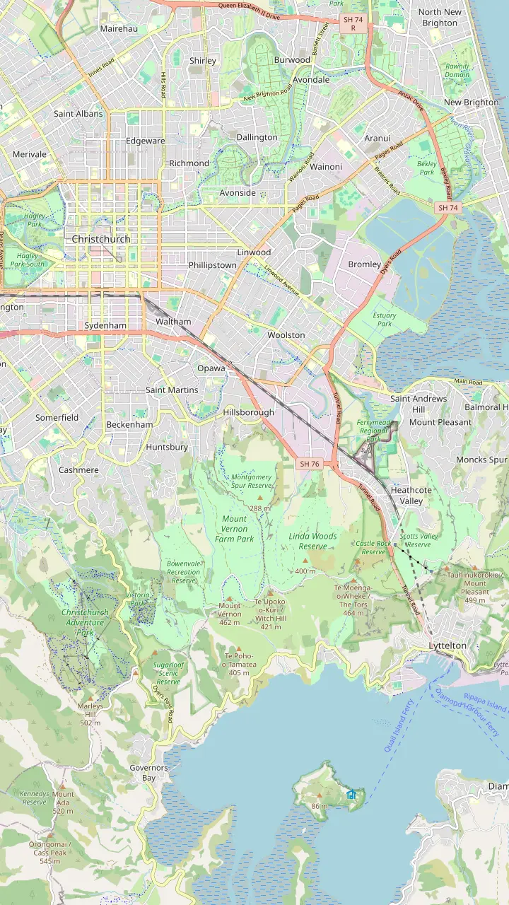
The Gondola Shuttle starts from Tram Stop 2 in the square.
Google MapsCatch bus 8 towards Lyttelton here, on the corner of Colombo and Lichfield Streets.
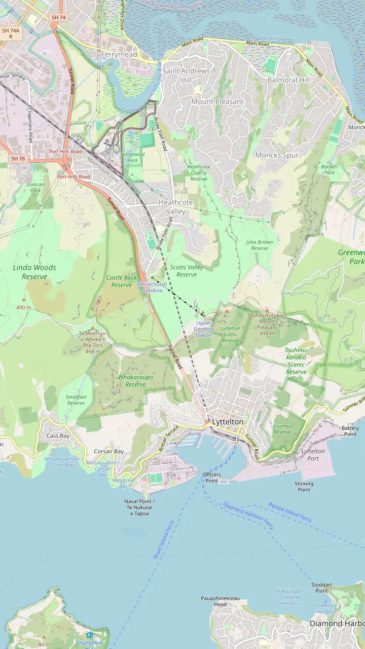
Google Maps10 Bridle Path Road, with plenty of parking for cars and coaches.
Google MapsBus 8 from Lyttelton drops you at the gondola's door; the operator allows 5 minutes by taxi or bus.
Google MapsThe valley the base station sits in; the city end of the Bridle Path starts just below the gondola.
Google Maps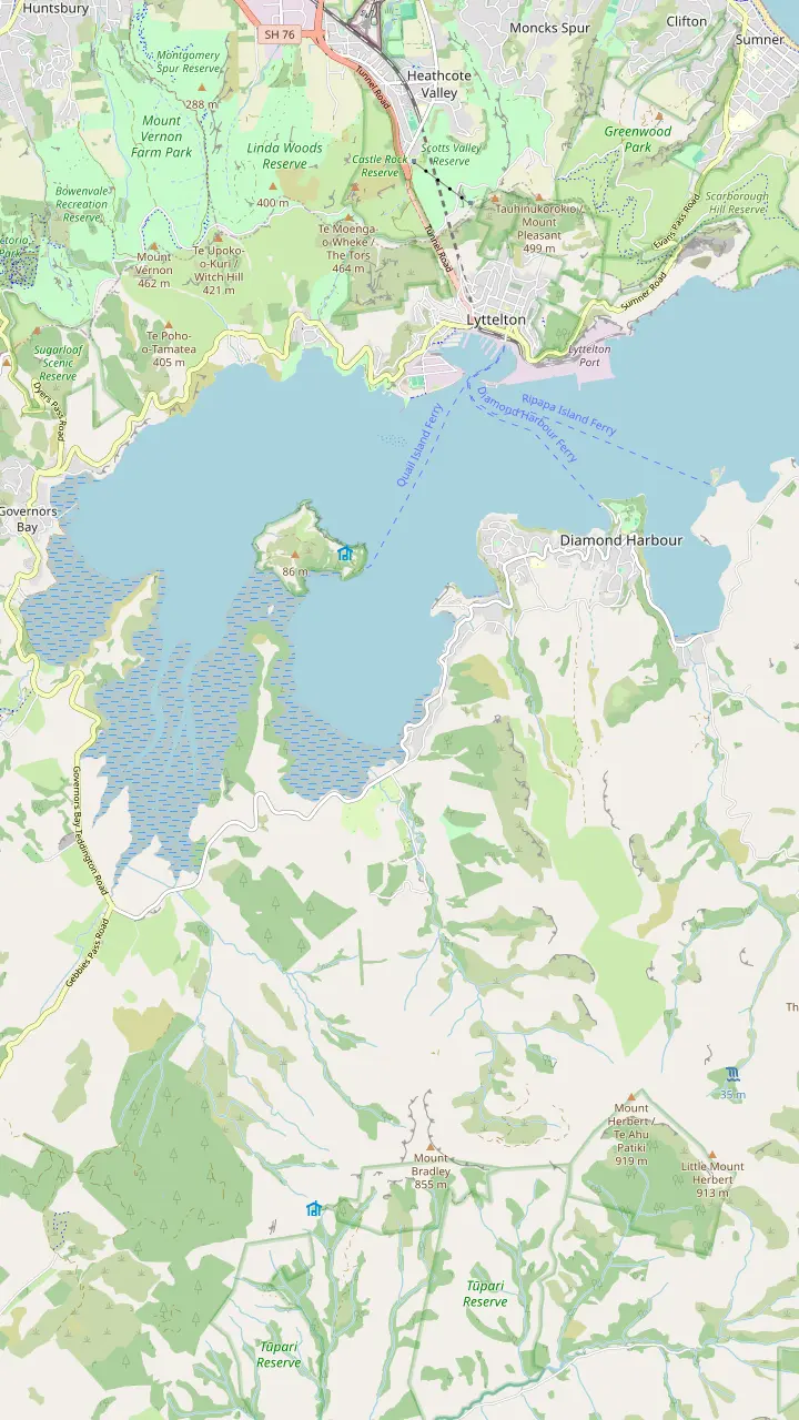
The harbour's old time signal: be there at 1pm to watch the ball drop.
Google MapsA ferry crosses from Lyttelton; settlers named the bay for the sun sparkling on the water.
Google MapsTe Ahu Pātiki, 919 metres, the highest peak on Banks Peninsula.
Google MapsHome of Te Hapū o Ngāti Wheke, one of the papatipu rūnanga of Ngāi Tahu.
Google MapsThe cone-shaped hill rising over Rāpaki, the mauka named in the Ngāti Wheke pepeha.
Google Maps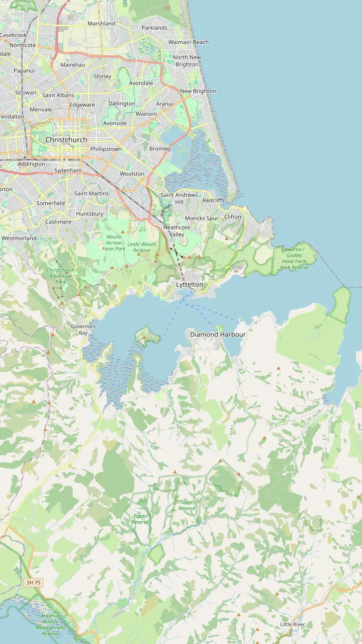
The transmission tower on its top stands at an elevation of 493.78 m, near Dyers Pass.
Google MapsThe Sign of the Kiwi, a rest house from Harry Ell's Summit Road plan; the Crater Rim walk to the Sign of the Bellbird starts here, 4km.
Google MapsThe Sign of the Takahe, a stone building Harry Ell planned in 1918.
Google MapsŌmāwete, the highest point of the Port Hills, 20 minutes one way from the Summit Road.
Google MapsŌrongomai, where Ngāti Wheke tradition says Ngāi Tahu heard Ngāti Mamoe.
Google MapsChristchurch's original downhill riding area with 71 trails, plus the Harry Ell Walkway, 4km.
Google MapsA 1.8 kilometre chairlift built to carry riders and bikes; entry to the park is free.
Google MapsThe coastal end of the hills, with 120-metre cliffs and wartime gun emplacements.
Google MapsThe Summit Road over Evans Pass, finished in 1857, ended the Bridle Path's days as the only way over.
Google Maps© OpenStreetMap contributors · map data
A Christchurch Gondola walk can be a half-hour stroll to a harbor lookout or a climb up the settlers' Bridle Path. Here are the tracks from the summit, the routes up and down the hill, and the tickets that make a one-way ride work.
Editorial team, christchurchgondola.top · Updated November 8, 2026 · 6 mins to read
Every Christchurch Gondola walk from the top begins in the same place. Head out onto the Level 4 viewing deck of the summit station and take the stairs down to the lawn below, where the tracks fan out.6 The operator's walks range from a 15-minute stroll to trails that take a few hours, and staff hand out maps at the station.7
The operator describes its main summit tracks in detail, and each returns the way it came, so you finish back at the café. They follow the Crater Rim walkway for their first stretch and then branch off, marked by orange markers along the way.8 Where several paths run side by side, look for the trail markers and red poles that show the right route.9
None of these walks is flat. The ground is rocky, and it can be slippery during or after rain.10 The operator asks for sturdy shoes, a hat against the sun and a warm layer; with almost no shade on the ridge, carry water and sunscreen too, and the shop on Level 2 sells the latter.11,12
Compare
| Track | Time | Distance | Grade |
|---|---|---|---|
| Cavendish Bluffs | 30 minutes | 1km | Easy |
| Pioneer memorial | 1 hour | 2km | Moderate |
| Gun emplacements | 2 hours | 5.2km | Moderate |
| Bridle Path | 2 hours | 4.8km | Steep in places |
Return times and distances from the operator for the summit tracks and from ChristchurchNZ for the Bridle Path.1,14,2,16,3,17,18,19
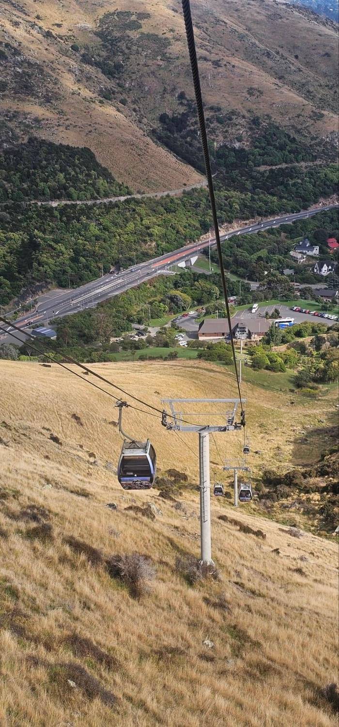
If you only have half an hour, this is the walk. The Cavendish Bluffs Lookout Track is 30 minutes return to a bluff that looks straight down over Lyttelton Harbour, Whakaraupō.1 It covers 1km return and is graded easy, though it has steep sections and steps.14
The reward is a clean view of the harbor and a look back at the summit station on its ridge, with a bench along the way for a rest.15 It is short enough to fit between lunch and the last ride, and the obvious choice when the light is good but the afternoon is running out.
To find it, follow the path under the cableway to a gate, go through and turn immediately right onto the Crater Rim walkway, then turn right again at the bench at the foot of the steps and follow the orange markers.8 A small sign marks the bluff as you approach. Come back the same way and you are at the deck again within the half hour.
The middle option heads for a piece of Canterbury history. The Pioneer Women's Memorial Track is 1 hour return to a memorial at the top of the Bridle Path.2 It covers 2km return and is graded moderate, with steep sections, uneven ground and steps.16
At the end is a stone shelter with covered seats, built in 1940 as a centennial memorial to the pioneer women of Canterbury.21 The views take in the harbor, the city and the Canterbury Plains, and the route passes native plantings with a seating area at the memorial itself.24 On a clear day the memorial makes a fine place to sit and take in the whole crater rim.
The start is shared with the Cavendish Bluffs track: under the cableway, through the gate, right onto the Crater Rim walkway and right again at the bench, following the orange markers and the signs for the memorial and the Bridle Path.8 Some sections split into parallel paths, so keep an eye on the red poles.9
Choose your walk
Start with how much time and energy you have, then pick the track.
If I have half an hour
Cavendish Bluffs
30 minutes return to a harbor lookout.1
If I want history on the way
Pioneer Women's Memorial
A 1940 stone shelter at the Bridle Path summit.21
If I want a proper hike
Mount Pleasant gun emplacements
2 hours return on farm tracks.3
If I want to walk up
The Bridle Path
Start from the carpark just below the gondola.22
If I want to walk down
One-way ticket, then the Bridle Path
If I have a dog with me
The Crater Rim from the Sign of the Kiwi
Dogs on a lead on that 4km section.23
Pick a track
Easy
Harbor lookout
Ride up and walk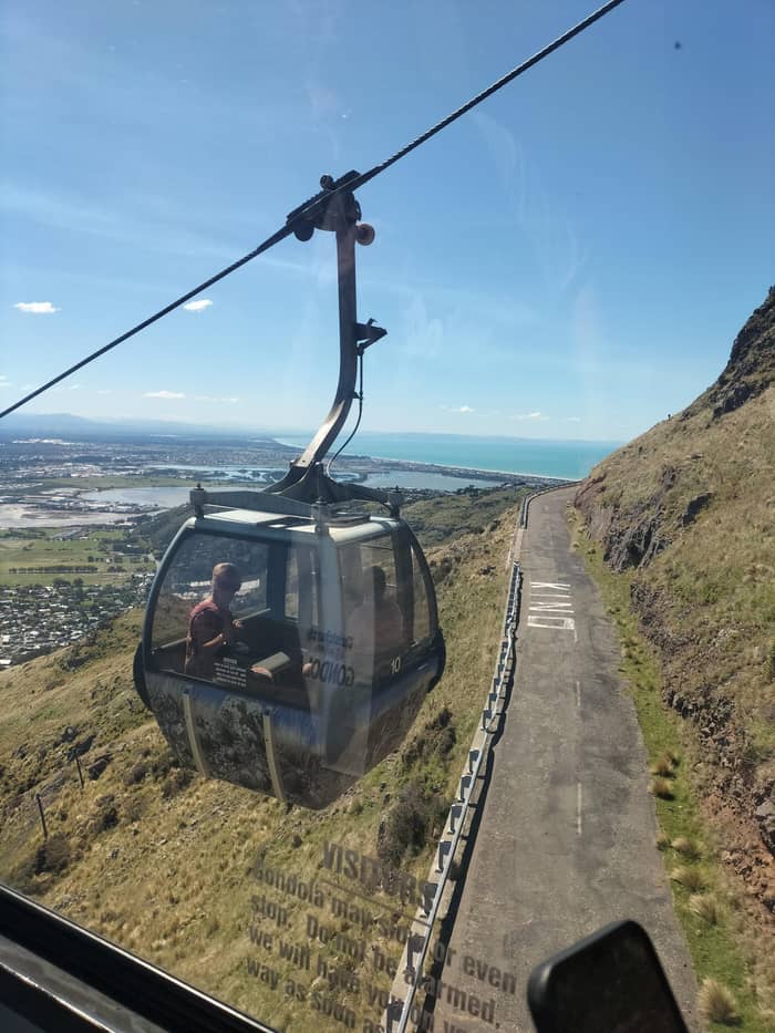
Moderate
Stone shelter on the crest
Ride up and walk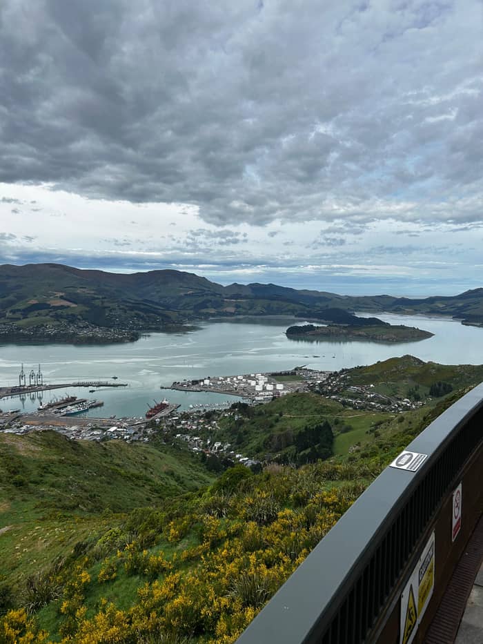
Longer hike
Wartime site near Mount Pleasant
Ride up and walkFor a proper hike, the operator suggests the track to the Mount Pleasant gun emplacements. It is 2 hours return, plus whatever time you spend exploring, to the remains of a wartime gun site with wide views of the harbor and the ocean.3 It covers 5.2km return and is graded moderate, with steep sections and uneven ground.17
This is farmland as well as reserve. You may share the track with sheep, and you will cross stiles and farm gates; leave every gate the way you found it.54,20 There is little shade on this route, which matters on a hot summer afternoon.20 Take more water than you think you need.
The route leaves the deck in a different direction from the other two. From the lawn, head away from the cableway and downhill to a gate, carry on to the carpark, then turn right, cross the stile and climb, following the orange markers and the signs for Mount Pleasant.8 Allow the whole afternoon if you want to enjoy the top rather than hurry back.
A ride-and-walk day
If you want to walk up to the Christchurch Gondola, the route is the Bridle Path. It was built in 1850 as a path for leading horses, and early settlers used it to travel from the port to the plains.55,56 It climbs to a height of 333 m on the ridge before dropping into Heathcote Valley.57
ChristchurchNZ gives the track as 4.8km, about 2 hours return, and says it is steep in places with views over the city, the Southern Alps, the harbor and Banks Peninsula.18,19 On the city side the track begins at the Bridle Path carpark below the gondola; on the Lyttelton side it starts from Bridle Path Road.22
Along the way are memorial seats honouring the pioneers and the first settler ships to reach Canterbury.58 The operator's guide notes that most of the commemorative stone seats on the route were built for the 1950 centenary.59 At the top, the stone shelter of the Pioneer Women's Memorial is a short walk from the summit station, where you can buy a one-way ride down.21,5
Video
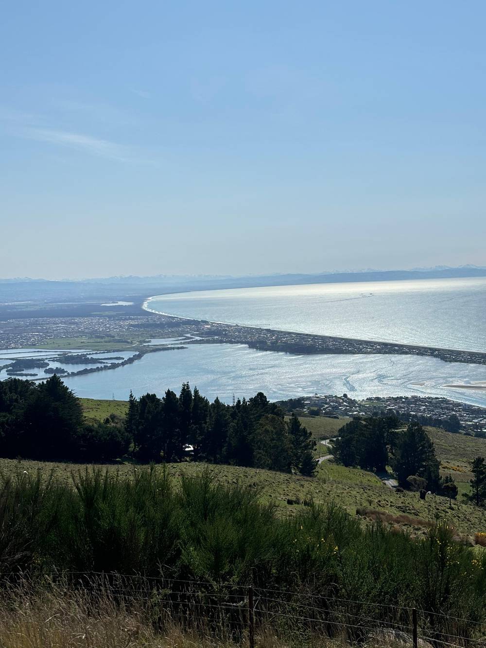
Dare To Elsewhere on YouTube · The clip loads only after you tap play.
Some sections have multiple paths, so pay attention to trail markers and red poles to show the correct route
Walk checklist
Can you walk down from the Christchurch Gondola? Yes, and it is an easy way to combine the ride with a walk. One-way tickets are sold at the base station and at the retail store at the summit, at NZD 25 per adult, NZD 12 per child and NZD 62 per family.5 Buy one at the bottom, ride up, and let your legs bring you home.
From the top, the operator's guide puts the walk down to Lyttelton or to Heathcote at about 45 minutes.4 Going down to Heathcote brings you back near the base station and your car. Going down to Lyttelton puts you in the port town, where bus 8 runs back past the gondola to central Christchurch.50 Downhill is hard on knees on the steep, loose sections, so take it slowly.
Do the sums on time before you commit. Summer opening is 10am to 5pm, and the final cabin down departs 60 minutes after the doors close, which matters if you plan to ride down after a long walk at the top.60 Keep the opening hours in mind and start your walk early enough to finish in daylight.
The summit is only one point on a long ridge, and the Crater Rim walkway links many others. ChristchurchNZ describes a 4km section from the Sign of the Kiwi to the Sign of the Bellbird that takes about 1 hr 30 mins, with dogs allowed on a lead.23 Another route from the Sign of the Bellbird runs 8km and 3 hours return.61
Closer to the city, the Rāpaki Track is 7km and 2 hours return, and it suits off-road prams.62,63 In Victoria Park, the Harry Ell Walkway takes about 2 hours over 4km.42 At the Christchurch Adventure Park, the uphill walking trail takes 1.5-2 hours one way, with a free chairlift ride to return.64,44
Before any of these, know the safety basics. Stay on the marked track, take all your rubbish with you, and in a medical emergency call 111.9,65,53 When the gondola reopened after the February 2011 earthquake, RNZ reported that the Bridle Path below it would stay closed while the council removed hazardous rocks, a reminder that this is steep, active ground.66,67
FAQ
One-way tickets are sold at the base station or the summit retail store: NZD 25 adult, NZD 12 child, NZD 62 family.5
The operator's guide allows about 45 minutes to walk down to Lyttelton or Heathcote.4
ChristchurchNZ lists a 4.8km track of about 2 hours return.18
Follow the path away from the cableway to a gate and the carpark, then cross the stile; it is 2 hours return.3
The Sign of the Kiwi to Sign of the Bellbird section allows dogs on a lead.23
Sources
Planning a ride up the Port Hills? A real person answers here.